Collection Search
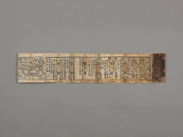
Paldojaean(八道在眼)
- Nationality Republic of Korea
- Quantity 1
- Era The end of the Joseon
- Exhibition Place -
- Material paper
- Size(cm) 160.0×12.0
A small atlas of 16 leaves (32 pages both front and back) comprising eight maps of the provinces (do) and accompanying regional information.
The front sides of the leaves show Gyeongsang, Hwanghae, Pyongan, and Hamgyong, while the verso sides show Gyeonggi, Chungcheong, Jeolla, and Gangwon.
Each Province has its own entries for records.
The very first part has maps indicating the locations and names of mountains, place names of each region, and rivers.
The next section shows stations (yeok 驛), garrisons (jin 鎭), forts (bo 堡), and fortresses (sanseong 山城).
Under stations are post stations (yeokcham 驛站), with place names inscribed below.
Next is the number of inhabitants’ dwellings, fields, number of vessels belonging to naval bases (suyeong), and number of commoners providing tax support (boin 保人).
The document also records the histories or the origins of important regions and distances from Seoul, among other details.
